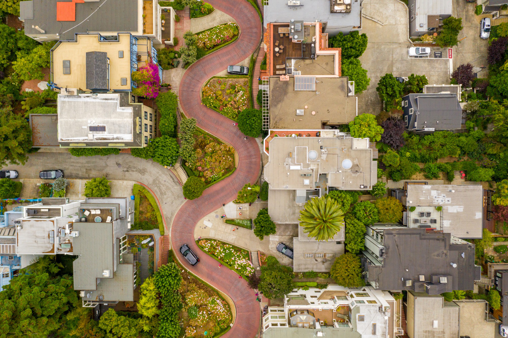
The real estate market is rapidly evolving, with drones now being used to capture unique aerial images of properties. Both residential and commercial real estate sectors are utilizing drone technology more than ever before. In fact, it’s become a standard expectation for residential property clients to have access to 8 to 10 stunning aerial shots when considering a property, showcasing everything from houses to apartments with or without land.
What is Real Estate Drone Photography?
The real estate industry has embraced drone technology with open arms, recognizing it as a highly valuable asset. Utilizing drones for aerial photography has revolutionized the way properties are showcased, adding a new level of creativity and innovation to listings. You now have the option to choose between traditional and aerial drone images, tailoring your visuals to meet your specific needs.
Traditional Images vs. Aerial Drone Images
Aerial drone images truly enhance the quality of photographs when compared to traditional methods. They provide a more comprehensive view of the property and allow viewers to seamlessly navigate through different elements, unlike static shots that require flipping back and forth.
How Have Drones Changed Real Estate Marketing?
Real estate drone photography is an effective visual marketing tool that has been shown to significantly speed up the sale of homes. Drones offer a unique perspective for buyers and are commonly used for various types of real estate listings. While drones can capture stunning visuals and panoramas, they come with a high cost and legal requirements for operation.
How to Get Started with Real Estate Drone Photography?
Now that you know how drone photography is used in real estate, let’s discuss how to get started with it.
Understand the Law
Before you begin using drone photography, it’s important to familiarize yourself with the local laws. Here are some rules to remember:
– Do not operate drones near airfields, airports, or aircraft.
– Keep your drone at least 150 feet away from property and people.
– Drones must stay below 400 feet.
In addition to these rules, there may be additional regulations depending on your location. Failure to comply with these laws could result in legal consequences.
Get a Proper License
Take the necessary steps to obtain a license to operate a drone for commercial real estate purposes. This includes passing the Part 107 test and maintaining FAA certification every 36 months. Keep your knowledge current by taking a recurrent aeronautical test every 24 months. Contact local authorities for guidance on drone regulations and best practices for real estate aerial photography. Conduct thorough research to ensure you are operating your drone legally and effectively.
Buy Your Photography Drone
Now that you have your drone license, it’s time to get a photography drone and start practicing. It may be tempting to jump right into real estate projects, but mastering this skill is essential to help your clients sell their properties quickly. Practice makes perfect!
Real Estate Drone Photography Tips
Set Up the Listing Landscape
Make sure to tidy up the area surrounding your home before using drone photography for listing photos. Remove any clutter from the yard, driveway, lawn, and roof as these can detract from the overall appearance. Shoot early in the morning when the streets are quieter for better photos. Consider trimming the lawn to make editing easier later on.
Adjust Drone Settings
Drone photography for real estate can be optimized by adjusting camera settings like aspect ratio and autofocus. Utilizing intelligent flight modes on modern drones, such as First Person View and Heads free mode, can also enhance the quality of your aerial photos.
Use Natural Light
Natural light is crucial for drone photography, as it adds a warm glow to real estate pictures. Shooting at noon can minimize shadows due to the sun’s position, while using neutral-density filters can help with harsh lighting. Sunrise and sunset are ideal times for shooting, but be mindful of the long shadows they can create.
Fly Your Drone Low
One common mistake to avoid in drone photography for real estate is flying too high up. This can limit the view to just the roof and surroundings of the home. To showcase the entire exterior of the listing, ensure to fly your drone closer to the house and capture every possible detail.
Highlight the Home’s Best Features
When showcasing a home for sale, highlighting unique features like a spacious lawn or a beautiful pool can help attract potential buyers. Enhance the lighting in these areas during editing to draw attention to them. Utilizing drone photography to capture the surrounding neighborhood, including nearby homes and green spaces, can also provide valuable information to interested buyers.
Bring Diversity into Shots and Angles
Adding variety in shots and angles can really enhance the overall look of real estate photography. Don’t just stick to high-up photos; make sure to capture all the exterior details like the garden flowers and deck. Getting aerial shots at 20 feet can strike a nice balance between the subject and its surroundings. Take multiple shots from the same angle to ensure you have the perfect shot for your real estate drone photography.
Shoot in RAW and Edit Later
Photography is all about capturing great shots and enhancing them through editing. To get the best results, it’s essential to shoot real estate images in RAW format to preserve their quality. Just make sure you have a spacious SD card to store those larger files without compromising their details.
Adobe Light room and Photoshop are widely-used tools for editing photos to meet clients’ preferences. Some prefer vibrant colors, while others opt for a more subdued look, especially in real estate photography. Many photographers now outsource their photo editing to save time and achieve professional results.
Also, visit featurestic.com for more quality information.

